Drone Survey in Sandwich: The Smarter Way to Inspect, Market and Assess Property
As technology continues to transform the property industry, drone surveys have become an increasingly valuable tool for homeowners, landlords, estate agents, developers and businesses. Whether you need to inspect a roof, assess land, market a property, or gather accurate visual data, a drone survey in Sandwich offers a safe, efficient and cost-effective solution.
At East Kent Energy Insights, we provide professional drone surveys and property marketing services throughout East Kent, helping clients gain a clearer perspective of their properties while saving time and reducing costs.
What Is a Drone Survey?
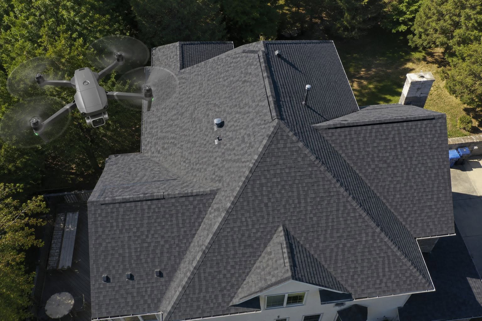
A drone survey uses unmanned aerial vehicles (UAVs) equipped with high-resolution cameras to capture detailed aerial photographs and video footage. Unlike traditional inspections that may require scaffolding, ladders or specialist access equipment, drones can safely reach difficult areas and provide a comprehensive overview of a property or site.
Drone surveys are commonly used for:
- Roof inspections
- Chimney assessments
- Property marketing
- Land and boundary surveys
- Development site monitoring
- Commercial property inspections
- Solar panel inspections
- Building condition assessments
By capturing detailed imagery from above, property owners can identify issues quickly and make informed decisions without the disruption and expense associated with traditional access methods.
Why Choose a Drone Survey in Sandwich?
Sandwich is one of Kent’s most historic towns, featuring a diverse range of properties, from listed buildings and period homes to modern residential developments and commercial premises. Many older buildings have roofing features, chimneys and architectural details that can be difficult to inspect safely from ground level.
A drone survey in Sandwich allows property owners to obtain detailed visual information without risking damage to delicate structures or requiring costly access equipment. The aerial imagery can reveal problems such as:
- Missing or damaged roof tiles
- Blocked or damaged gutters
- Chimney deterioration
- Water ingress points
- Storm damage
- Structural concerns
- Vegetation growth affecting buildings
Early identification of these issues can help prevent more expensive repairs in the future.
Benefits of Professional Drone Surveys
Improved Safety
Traditional roof and building inspections often involve working at height, which carries inherent risks. Drone technology significantly reduces these risks by allowing surveyors to inspect elevated areas remotely while remaining safely on the ground.
Cost-Effective Inspections
Hiring scaffolding or cherry pickers can be expensive and time-consuming. Drone surveys eliminate many of these costs while still providing detailed visual information that can assist with maintenance planning and property management.
High-Quality Visual Data
Modern drones capture exceptionally detailed images and video footage. This allows property owners, contractors and surveyors to zoom in on specific areas and analyse potential issues with greater accuracy.
Faster Turnaround Times
A drone survey can often be completed far more quickly than traditional inspection methods. This means clients receive valuable information sooner, helping projects move forward without unnecessary delays.
Drone Surveys for Property Marketing
Drone technology is not only useful for inspections. It has become one of the most effective tools available for property marketing.
Aerial photography and video footage help showcase a property’s location, gardens, surrounding landscape and unique features in ways that standard ground-level photography simply cannot achieve.
For estate agents and property owners preparing a property for sale, a drone survey in Sandwich can create compelling marketing materials that attract more attention from prospective buyers.
At East Kent Energy Insights, we offer property marketing packages that can include:
- Professional property photography
- RICS-compliant floor plans
- 360° virtual tours
- Drone photography and video
- Energy Performance Certificates (EPCs)
Combining these services provides buyers with a complete understanding of a property’s layout, condition and surroundings before arranging a viewing.
Supporting Homeowners, Landlords and Businesses
As a family-run business based in East Kent, East Kent Energy Insights understands the needs of local property owners. We work with homeowners, landlords, estate agents, developers and businesses to provide reliable property information and professional reporting.
Alongside drone services, we also offer:
- Domestic EPCs from £60
- Landlord EPCs
- Domestic energy assessments
- Energy efficiency advice
- Legionella risk assessments
- Floor plans
- 360° virtual tours
- Property photography
Our goal is to provide practical, affordable solutions that help clients make informed decisions while meeting legal and marketing requirements.
Frequently Asked Questions About Drone Surveys
Are drone surveys safe?
Yes. Professional drone surveys are conducted by trained operators who follow current aviation regulations and safety procedures. The process allows inspections to be carried out without the risks associated with working at height.
How long does a drone survey take?
The duration depends on the size and complexity of the property or site. However, most residential drone surveys can be completed relatively quickly compared to traditional inspection methods.
Can drones inspect roofs?
Absolutely. Roof inspections are one of the most common applications of drone technology. High-resolution imagery allows surveyors to identify defects, damage and maintenance requirements without physically accessing the roof.
Are drone surveys suitable for commercial properties?
Yes. Drones are widely used for commercial buildings, industrial premises, development sites and land surveys. They provide valuable visual data that can support maintenance, planning and project management.
Choose East Kent Energy Insights for Your Drone Survey
If you are looking for a professional drone survey in Sandwich, East Kent Energy Insights provides a dependable service backed by local knowledge, modern technology and a commitment to customer satisfaction.
As an Elmhurst Energy Accredited company, we pride ourselves on delivering accurate assessments, high-quality imagery and practical property solutions across East Kent. Whether you require a roof inspection, aerial photography, floor plans, EPC certification or complete property marketing support, our experienced team is ready to help.
A drone survey in Sandwich can provide valuable insights, improve safety, reduce inspection costs and help present your property at its very best. Contact East Kent Energy Insights today to discuss your requirements and discover how our professional drone survey services can support your next property project.